

Guest post by: Kateryna Sergieieva, Data Scientist at EOS Data Analytics
In today’s world, sustainability is a term used frequently. Scarcity of resources and the effects of climate change highlight the need to transform business processes. A clear commitment is essential, and many stakeholders are no longer satisfied with self-reported disclosures. To comply with credible ESG reporting standards, companies are turning to satellite technology.
Satellite-based monitoring is transforming how organizations access and interpret environmental intelligence. Some programs, especially ESA’s Copernicus, enable organizations to move beyond estimations and toward measurable, auditable ESG performance. The use of Sentinel-2 imagery is becoming not just advantageous, but essential to provide the transparency required to validate environmental claims and support the transition toward net-zero supply chains.
The Challenge: Verifying Deforestation-Free Supply Chains
Approximately 21% of global anthropogenic greenhouse gas emissions come from agriculture, forestry, and other land-use related activities. Land-use changes—primarily deforestation—account for nearly half of these emissions, and for many companies, this impact dominates their Scope 3 emissions profiles.
Despite this, verifying whether supply chains are truly deforestation-free remains a persistent challenge. Traditional approaches rely heavily on certification schemes, periodic field inspections, and self-reporting, methods that are often fragmented, expensive, and difficult to scale globally. Furthermore, they lack the objectivity required for regulatory scrutiny.
Regulation is tightening, and companies must demonstrate that commodities placed on the EU market are not linked to deforestation after a specified cutoff date. That’s why Sentinel data access becomes critical, as it enables companies to monitor supplier regions remotely through its geolocation data, traceability, and verifiable proof.
Satellite data analysis contribution to environmental preservation
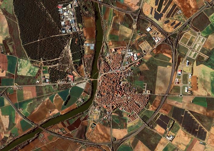
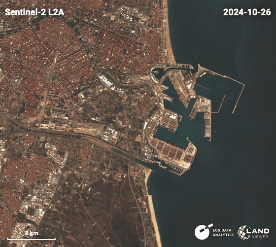
The Copernicus Sentinel-2 mission represents a major advancement in EO. Providing optical imagery at 10-meter spatial resolution with a revisit time of around 5 days, it offers a powerful combination of detail and frequency. This makes Sentinel-2 data particularly effective for environmental monitoring at scale.
Compared to older datasets—often limited to coarse resolutions—modern Sentinel images enable analysts to detect subtle environmental changes, including small-scale deforestation, agricultural expansion, and forest degradation, among others. Another advantage of the Sentinel missions is the availability of advanced tools, such as ESA WorldCover, which combines radar data from Sentinel-1 and optical data from Sentinel-2 to produce high-accuracy global land-cover maps. These capabilities allow organizations to identify risks early and act proactively.
Beyond this, satellite data analysis supports sustainable land management by enabling the detection of illegal activities, the optimization of agricultural practices, the close monitoring of water use at the regional or country level, and the tracking of soil health over time. By implementing data-driven environmental strategies at low or no cost through satellite technology and constellations like Sentinel-2, companies can closely align with their ESG objectives.
How to detect deforestation with satellite data
Besides agricultural intelligence, one of the most powerful applications of Sentinel-2 satellite images is the detection of deforestation events. By leveraging multi-spectral data with a suite of techniques and features commonly available in analysis software and online platforms, users can identify vegetation and land cover changes with high precision.
One useful feature of Sentinel-2 data is vegetation indices, which provide quantitative parameters of plants and soil. The most popular one is the NDVI (Normalized Difference Vegetation Index), which indicates plant health based on light reflectance, while NDMI (Normalized Difference Moisture Index) measures water content. There are dozens of options available, each one with a specific use case.
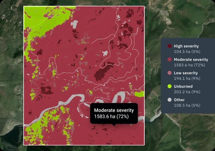
Change detection algorithms and spectral analysis also play their role in this task. The former compares imagery across two or more time periods to detect changes in land cover, while the latter assesses spectral signatures from different land surfaces to classify land cover types and detect transitions.
All these techniques enable near real-time monitoring of deforestation, often detecting illegal activities before they are reported through traditional channels. At the same time, they ensure that organizations maintain up-to-date visibility over their supply chains.
Implementation considerations for companies
While the benefits of satellite monitoring are substantial, successful implementation requires careful planning and technical alignment. Organizations should consider the following factors:
- Data integration capabilities. Satellite insights deliver maximum value when integrated into existing enterprise systems. APIs and automated workflows enable seamless integration of Sentinel-2 data into ESG reporting dashboards and carbon accounting tools, ensuring decision-makers have actionable intelligence rather than isolated datasets.
- Spatial and temporal resolution requirements. Sentinel-2 satellite images offer an optimal balance of cost, coverage, and detail for most large-scale ESG applications. However, some applications may require higher resolution; for instance, monitoring small, richly detailed areas requires sub-meter resolutions.
- Validation and accuracy. ESG regulatory compliance demands robust validation, and datasets must be cross-checked against ground truth or independent benchmarks.
- Technical expertise. While user-friendly platforms are emerging, working with satellite imagery requires specialized knowledge in remote sensing, geospatial analysis, and GIS systems. This means companies may need in-house or external experts to conduct some analysis. Effectively interpreting images is as important as access to the data itself.
Satellite technology is redefining how organizations approach ESG compliance. The widespread availability of satellite data, combined with the analytical power of modern EO tools, enables companies to move from reactive reporting to proactive environmental management. By leveraging data sources like Sentinel-2, organizations can achieve unprecedented transparency across their supply chains. As ESG expectations continue to rise, integrating Sentinel-2 data into business strategies will become a defining factor in credible, data-driven sustainability leadership.
About the author:
Kateryna Sergieieva has a Ph.D. in information technologies and 15 years of experience in remote sensing. She is a scientist responsible for developing technologies for satellite monitoring and surface feature change detection. Kateryna is an author of over 60 scientific publications.